Day 3 - Shira to Fischer Camp (12,950 ft./3850 m) |
| Home | Day 1 | Day 2 | Day 4 | Day 5 | Day 6 | Day 7 |
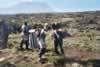
There's a hard frost on our tent and the ground this morning when we awake for tea at 7 a.m. It's another spectacular day, sunny but cold and windy. By the time we break camp, it has warmed up considerably. Card #3 has pictures of our three daughters (3 days/3 daughters; Louise has a daughter also). We share the card with Victor, Raymond, Kambona, and Eduardo and others, and this becomes part of our morning routine.
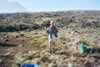
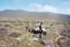
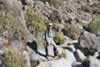
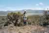
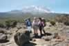
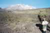
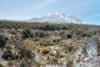
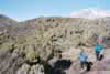
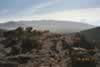
Today's hike is across the Shira plateau, which was formed when the Shira volcano collapsed. The walking is easy, on fairly level ground covered with sage brush and lava formations. The last hour or so is more difficult, as we ascend ~1,000 feet to reach Fischer camp, named for Scott Fischer who pioneered this particular route but was tragically killed on Everest. After lunch at camp, we spend some time exploring the area and admiring the giant groundsel (Senecio kilimanjari), which looks like a cactus.
Photos from June 14, 2003.
Day 3 begins |

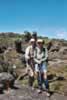
We're ready to start hiking |
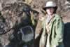
Victor, our guide |
Sage brush and lava rocks |
En route. |
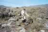
Taking a break |
3Crossing the Shira plateau. |
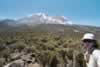
Kili's getting closer |
Shira plateau - a collapsed volcanic crater. |
Victor and Raymond, our assistant guide. |
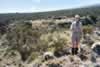
Louise. |
Upper Heath Zone |
Kibo summit in background |
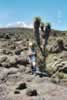
Groundsel cactus |
Scott Fischer plaque. |
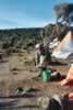
Katadyn water filter |
Exploring Fischer Camp |
Fischer Camp at dusk |